Roadtrip from California to New Orleans
By Nick Mattison
Photo Credit for most of the page goes to Cameron Zacher
I moved to New Orleans in 2015 from California, more specifically Northern California, even more specifically, Berkeley. I had spent the first 18 years of my life living in California’s capital city of Sacramento, followed by 5 years of college in San Luis Obispo, and 2 years as a young professional in the Bay Area (Berkeley). Up to this point, the longest I’d spent outside of California at a time was the 3 months I worked in India with Engineers without Borders. So even though I loved my sunshine, mountains and hills, rocks and ocean, I was eager to see and try something new. Then, came along an opportunity to move to the Big Easy…
After a little bit of trip planning, I packed my 2003 Subaru Outback and with 3 close friends, set off on a fast-pace 10 day road trip to New Orleans.


California to New Orleans road trip map. For an interactive map, use the following link: Interactive Map on Google
Departure from Berkeley
Since all four of us were from California and had done some pretty thorough exploration of The Golden State already, we decided to hustle as quickly as possible to The Grand Canyon from Berkeley (easily our longest stretch of driving). So, equipped with one last burrito from Gordo Taqueria, season one of the Serial Podcast and a variety playlists, we started our 11 hour journey toward Northern Arizona.

Cameron being really stoked about having a Gordo Taqueria burrito.
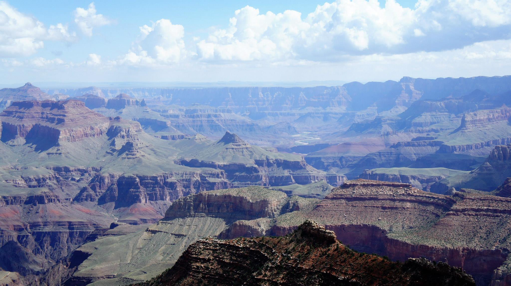
Grand Canyon National Park
After a brief night in Bakersfield (to break up the drive) and a stop in Flagstaff (where I bought my first rain jacket ever...and incidentally didn't have rain the rest of the trip), we finally made it to our campground at the Grand Canyon! We stayed at the Ten-X Campground, which is in a beautiful wooded area and a 15 minute drive from the South Rim of the Grand Canyon.
In the morning, we made no delay, all of us excited to finally experience the natural world wonder we'd heard about our entire lives. And I'm not going to lie...when you walk to the edge of the Grand Canyon and look out and see the vast abyss between you and the North Rim, the mile deep crevice below you, the intricate network of colorful canyons and ridges that have been carved out over the last 5 million years, you feel awed, you feel entranced, you're really not sure how to react. It's simply magnificent. Photos cannot do it justice, sorry...
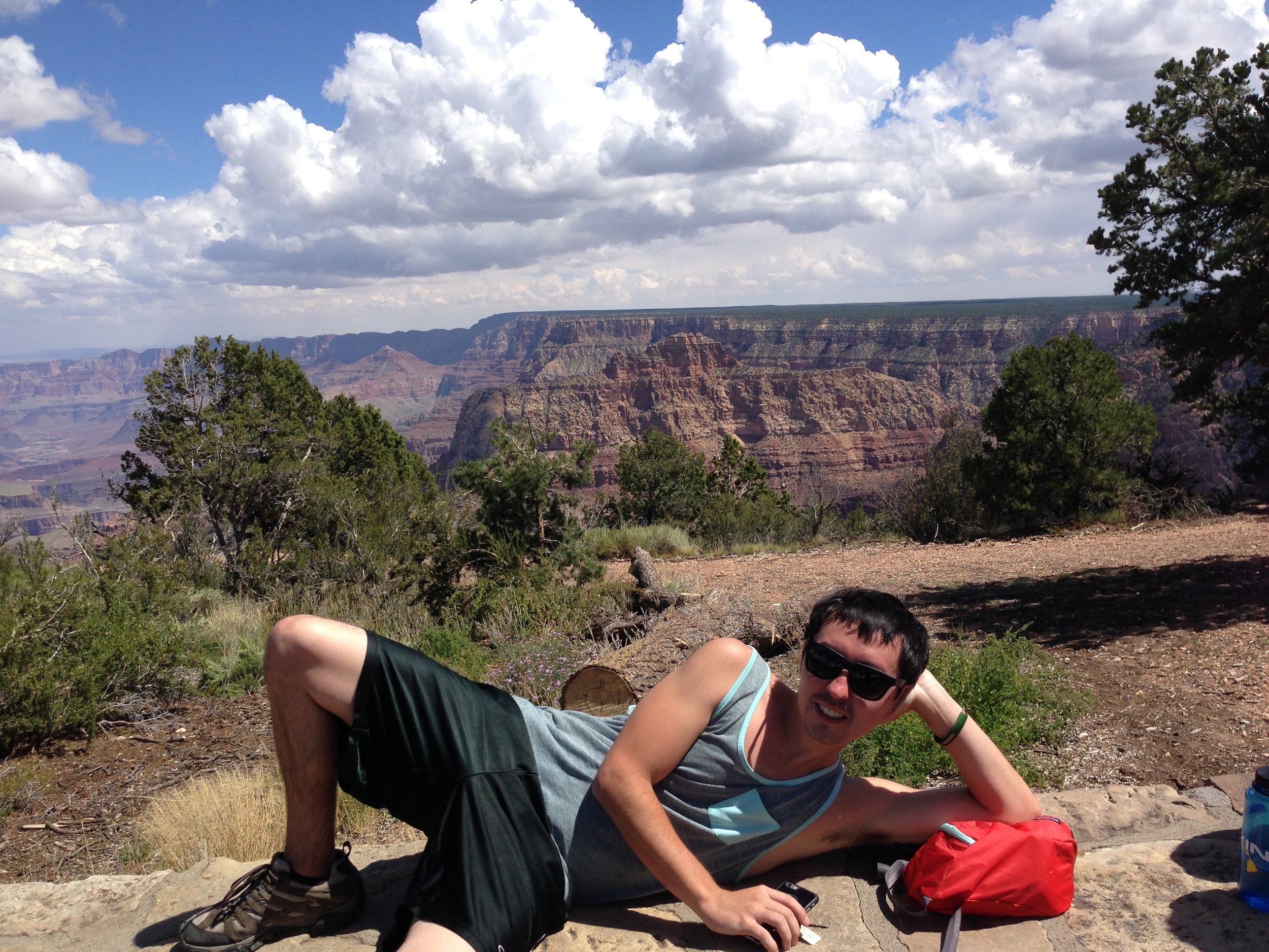
Knowing that we didn't have a ton of time and needed to hit the road again soon, we decided to do a short hike along the Grandview Trail to Coconino Saddle (2.2 mile roundtrip). Here's a fair warning to all reading this, that is a long mile back up. The trail is extremely steep and relatively unmaintained, making for an intense short hike, but the different perspective from inside the canyon makes it totally worth it.

View from the Grandview Trail in Grand Canyon National Park
After one last 30 minute bewildered glance at the canyon and a quick start and end to Matt's modeling career, we piled back in the car and took off for our next stop.
Matt posing at the Grand Canyon
Oljato-Monument Valley
Back on the road, we didn't find a moment of boredom with each passing mile as the landscape had turned into something oddly martian. There seemed to be an endless supply of canyons and rock formations unlike anything I'd ever seen in California and everything was SO RED! Needless to say, we stopped the car a few times to do some exploring along the way.
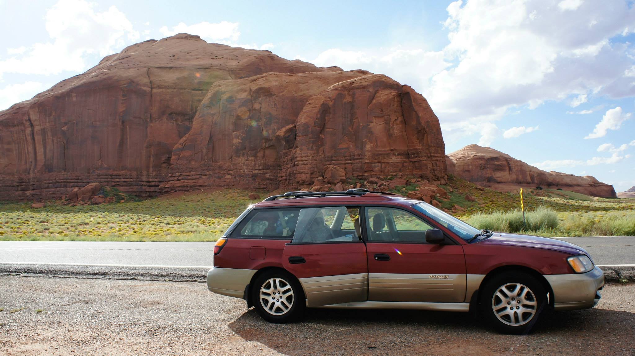
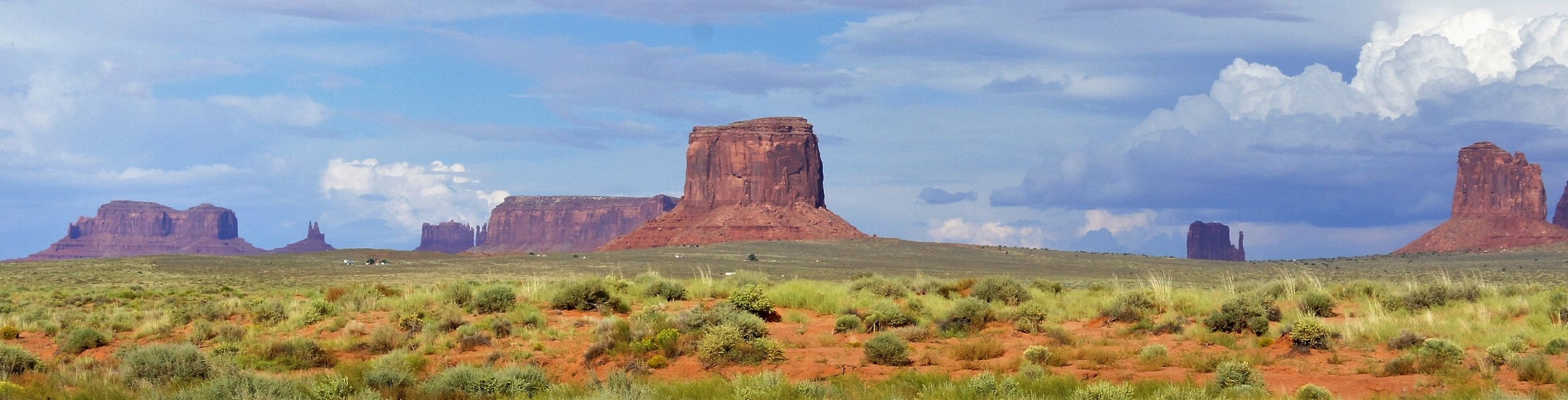
Eventually we did actually make it to Monument Valley and it was every bit as strange and fascinating as I thought it would be, though we were fairly warmed up to these gigantic formations by this point due to our multi-hour drive from the Grand Canyon. But if you're looking for astonishing buttes, there's really no beating this valley.

If you're wondering how these isolated structures of nearly vertical walls and flat tops (also known as buttes) are created, National Geographic provides a pretty solid explanation. Check out their page here (hint, hint...its wind and erosion).
We weren't at Monument Valley very long before THE OPEN ROAD called our names again. After a quick pit stop in Mexican Hat, where things got a little weird (see photo below), we continued on to our campground in Blanding, Utah, which would serve as our base for Natural Bridges National Monument the next day.

A demonstration of the excitement one feels upon arrival in Mexican Hat, Utah.
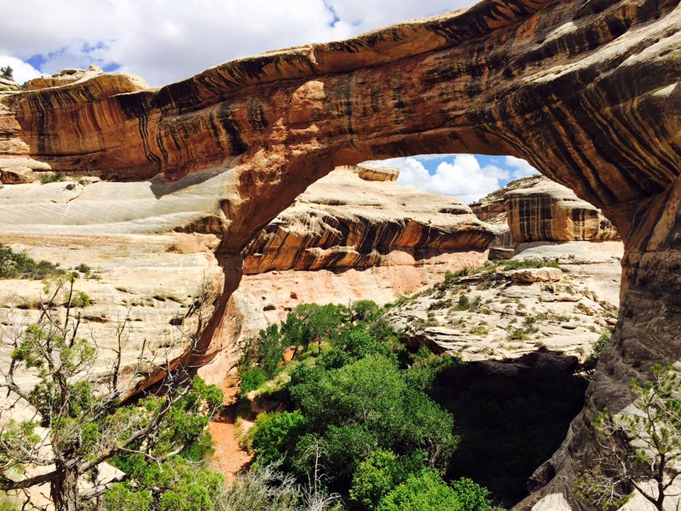
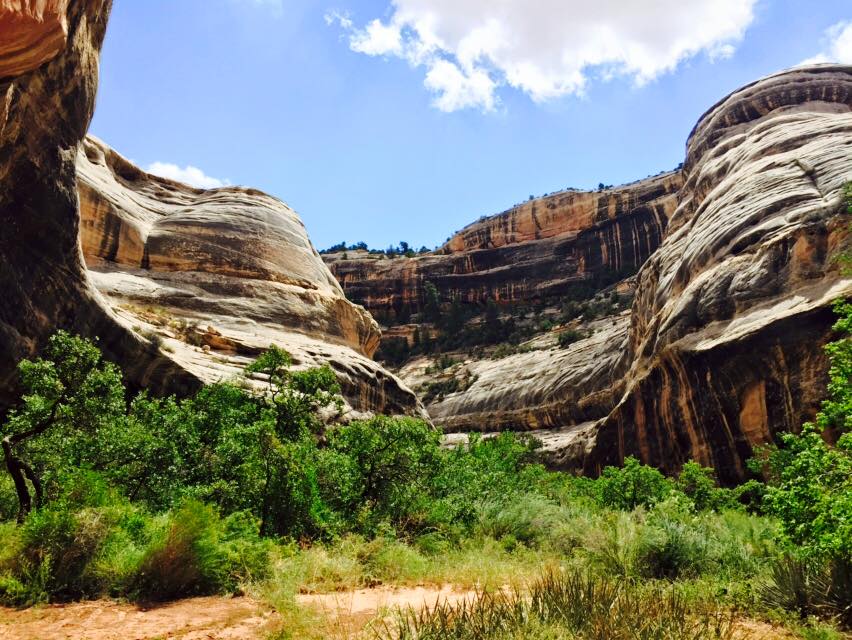
Natural Bridges National Monument
We awoke the next day and though slightly hungover from the excess of Snappa that took place the night before, took down our tents, packed the car, and drove the hour and a half to Natural Bridges National Monument. We decided to take the hard core route and hike the 8.6 mile Loop Trail, which features three massive natural bridges. One of which is Sipapu Bridge, an impressive 220 ft (67.1 m) tall and 268 ft (81.7 m) long. The Loop Trail also includes some pretty cool Native American ruins and cave paintings.
Word of advice for anyone interested in tackling this loop trail, BRING LOTS OF WATER. The trail follows the bottom of a canyon without many exits, making a quick escape nearly impossible. There are also shorter hikes to the individual natural bridges. If its raining, you should probably just skip the trail because flash floods, as the name suggests, can happen unexpectedly.
Feeling accomplished and exhausted, we pointed the car toward Moab to set up camp for our excursion into Arches National Park the next day.

Arches National Park
We entered the park first thing in the morning, hit the visitors center, watched the orientation video, and were soon on our way to explore the park's brilliant sandstone arches, windows, and formations. The major features at Arches National Park are a bit more spread out than Natural Bridges and require a car to see everything in one day. That being said, there are OVER 2000 sandstone arches in the park so regardless of where we parked, the surrounding landscape was countlessly littered with these geological oddities.
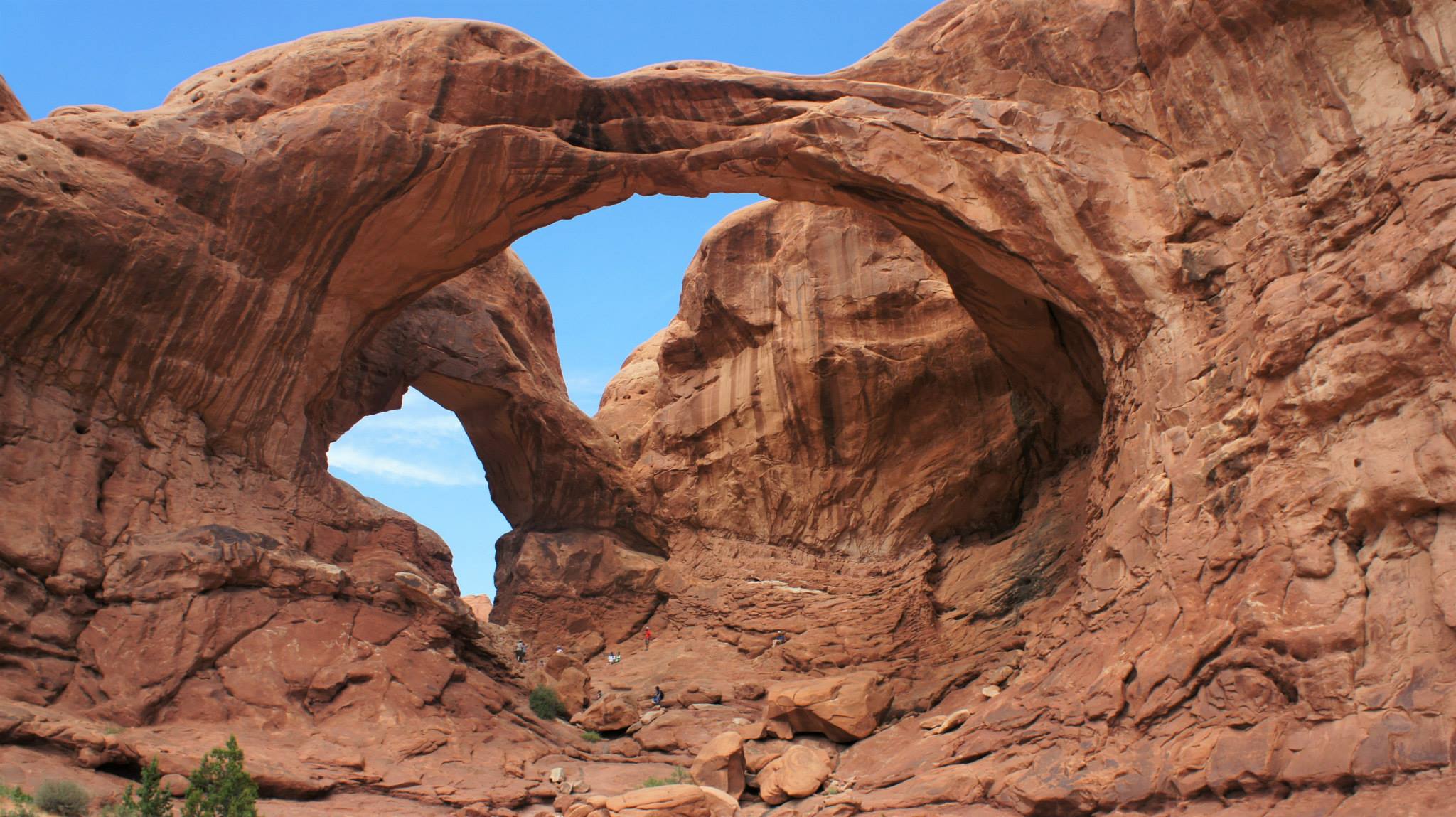
There were three features in Arches that stood out most to me. The first being Double Arch, which (as you may have guessed) has two GIANT arches right next to each other, making for an incredible visual. Fun Fact: Double Arch is featured in the opening scene of Indiana Jones and The Last Crusade.
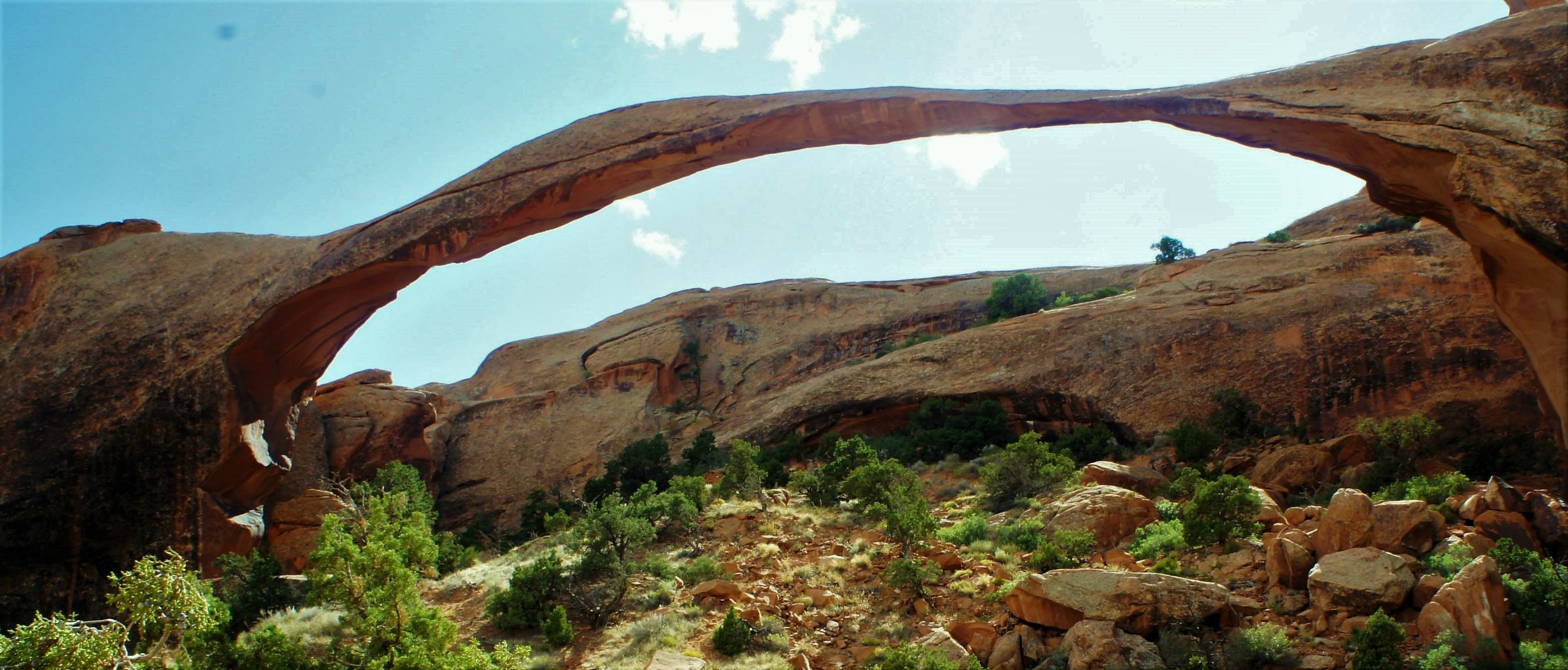
The second feature that stood out was Landscape Arch, running 290 feet across the sky making it the longest natural arch in the western hemisphere (5th longest arch in the world according to the NABS). Aside from the obviously impressive length, the reason why this monster arch was so memorable was the eerie feeling I got standing near it (within 500 feet) that it could collapse under its own weight at any time. In fact, the thinnest section of Landscape Arch is only 6 feet thick! Remember...290 feet in length; that's a pretty thin section. To top it off, the last time a large section of this arch broke off and came crashing to the ground (a 73 foot long slab of rock) was only in the year 1991. Amazingly, a Swiss tourist caught this moment on camera. Skip to 1 min, 53 sec to check out her footage:
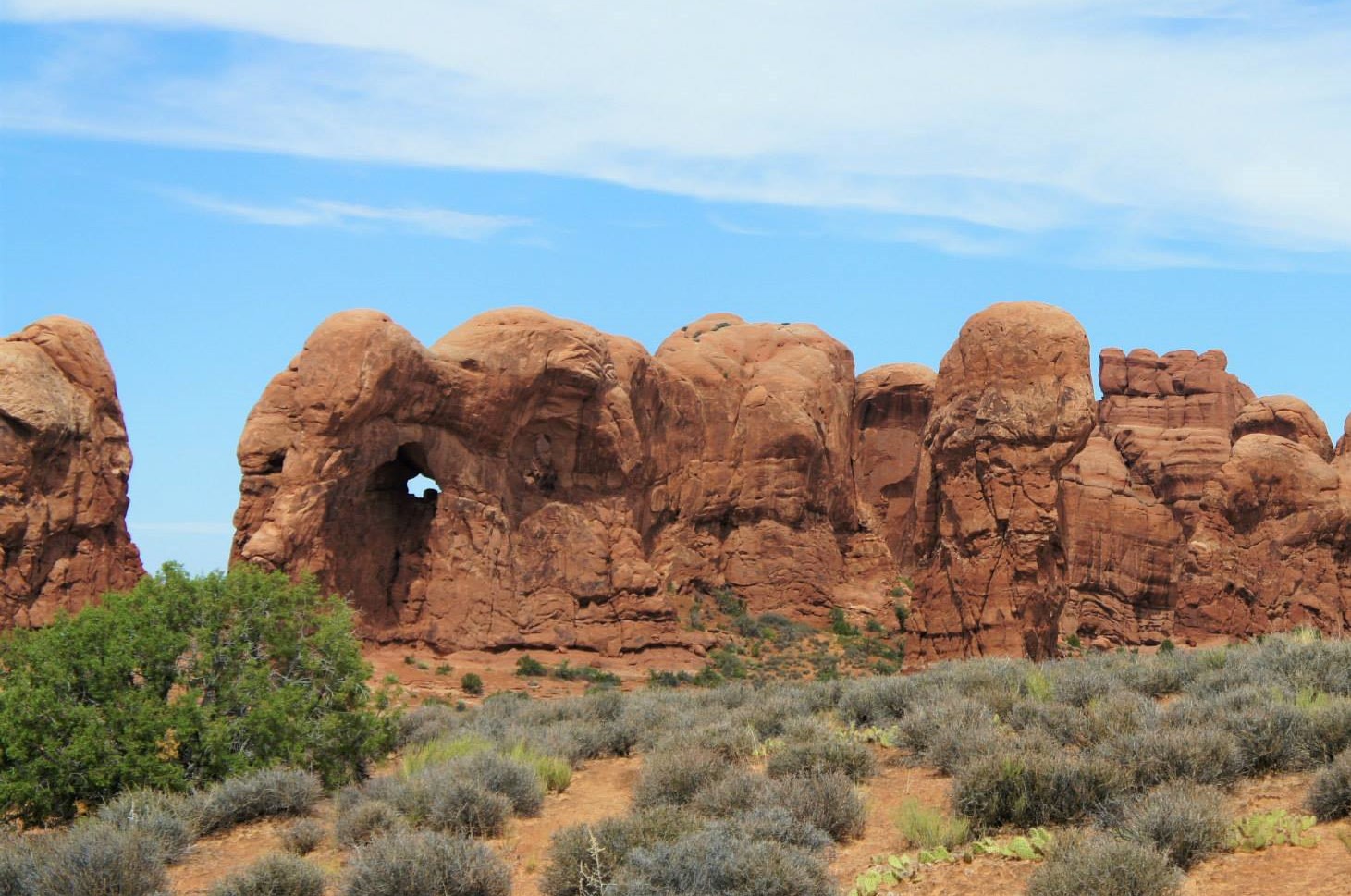
The third natural feature that blew me away was the "March of The Elephants." I want to emphasize the natural part because seriously, it looked like a freaking elephant has been sculpted out of stone. But instead of an artist with hammer and nail, wind and rain created this masterpiece.
I'd highly recommend stopping by the Visitor's Center on the way into the park and watch the orientation video. This well done documentary explains how the park's geological features were formed and why they're constantly changing. If you don't feel like waiting for the visitor center documentary, here is a three minute video explaining their formation.
By the way, the bridges at Natural Bridges National Monument are created very differently than the formations at Arches. A "natural bridge" is generally created by flowing water. You can learn more on the Natural Arch and Bridge Society website.
Anyway...it was a long and exciting day at Arches National Park. We ended our time in Utah with a well deserved beer and burger at Moab Brewery. Bellies full and satisfied, we hit the road toward Morefield Campground in Mesa Verde National Park.

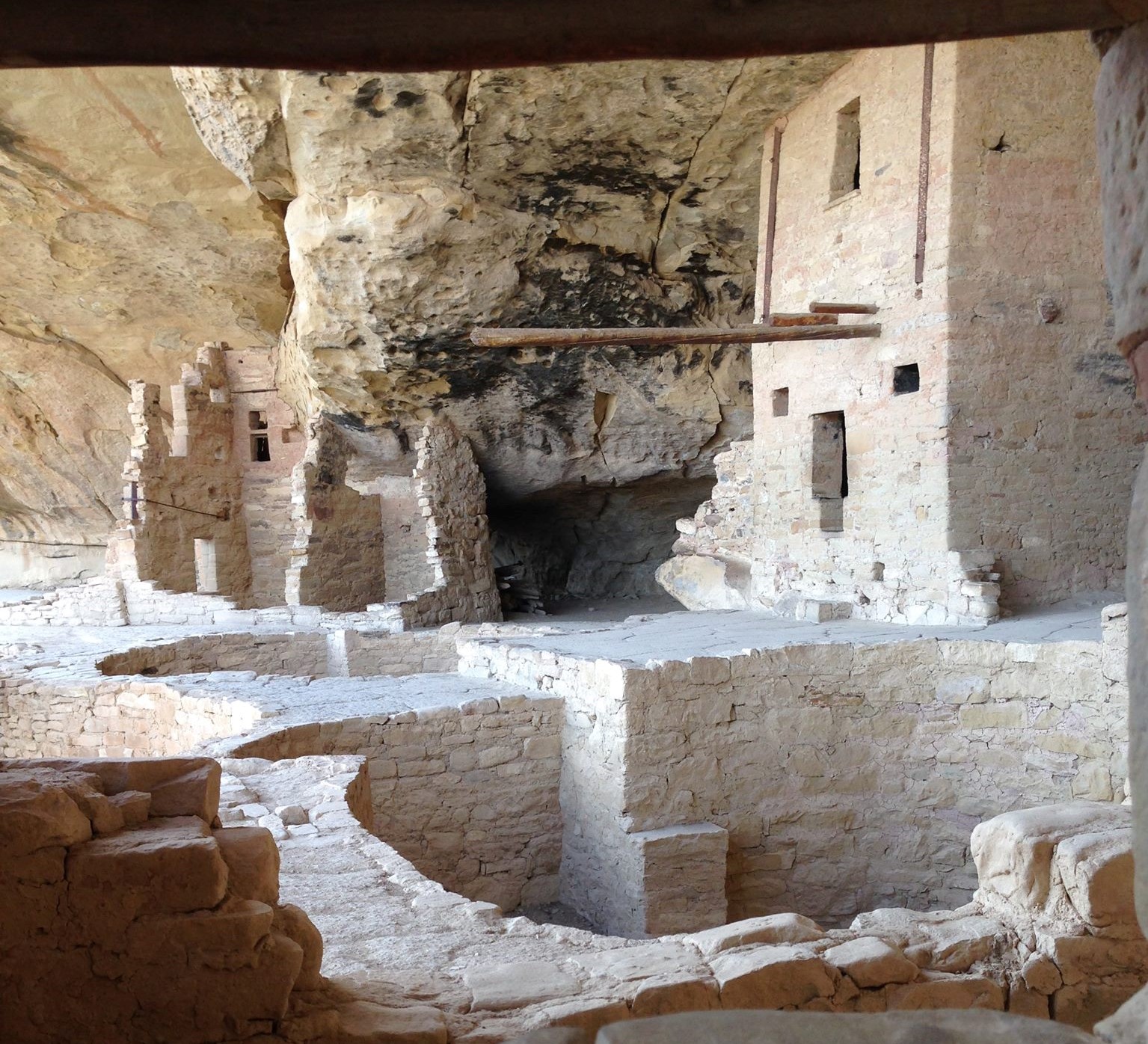
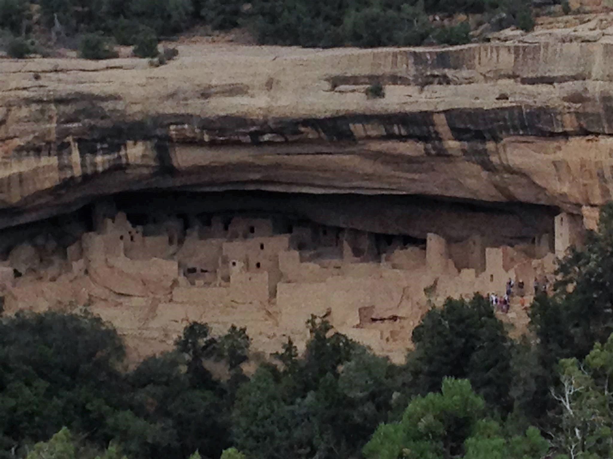
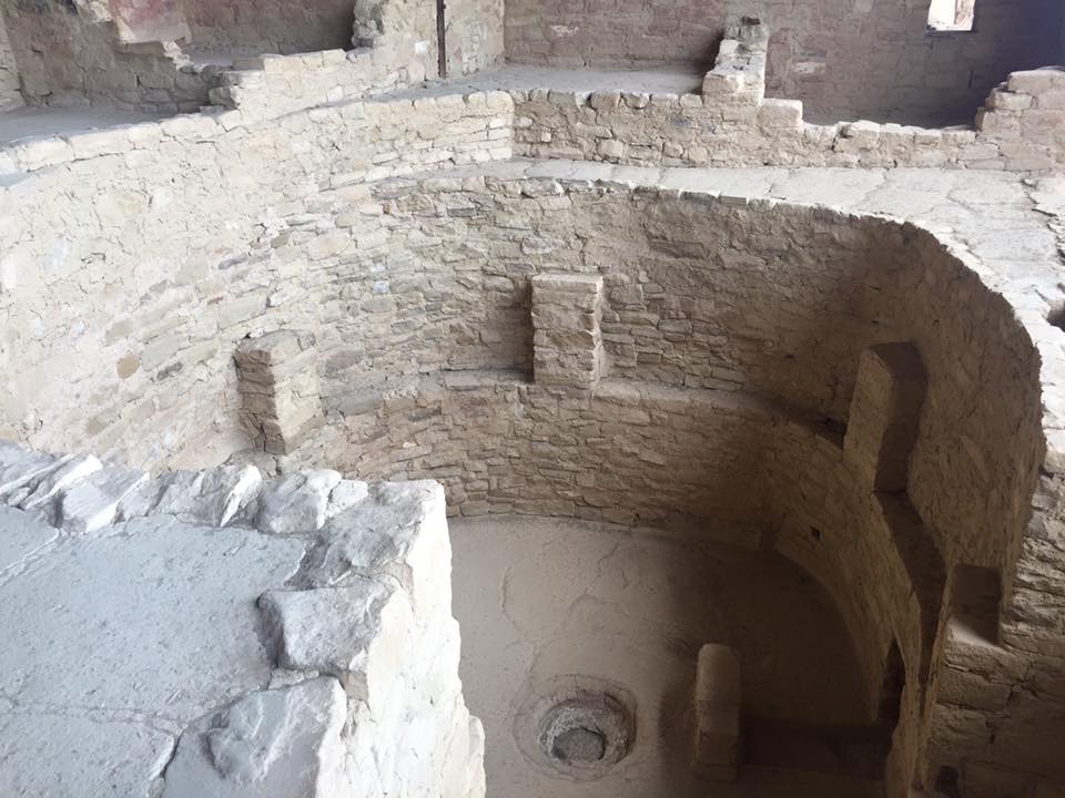
Mesa Verde National Park
Up to this point in the trip, every destination we visited had been shaped by the sands of time (totally felt it was of the utmost necessity to use that phrase in this article). Our time in Mesa Verde National Park was about something very different - the creations, more specifically the cliff dwellings built by the Ancestral Pueblo People more than 700 years ago! As the name suggests, these impressive stone communities were built into Mesa Verde's canyon walls, primarily under overhanging cliff sections. Follow these links to learn more about these cliff dwellings and the Ancestral Pueblo People of Mesa Verde.
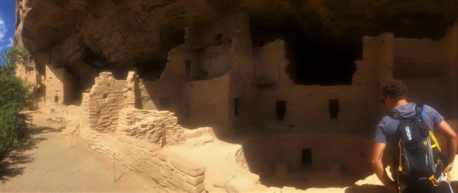
We opted to do the Balcony House ranger-guided tour (visitors are only allowed to visit Balcony House and the Cliff Palace via guided tour) and Spruce Tree House self-guided walk (no guide required). The ranger-guided tour was great for getting the full visual experience at Balcony House. Wandering through this amazingly well preserved cliff dwelling with a ranger breaking down the historical and cultural details made it much easier to envision how the Ancestral Pueblo People may have lived.
ALBUQUERQUE
I'm gonna be real with y'all. We did not do much in Albuquerque. It was essentially a half way point between Mesa Verde and Carlsbad Caverns. We got there pretty late in the night, and heck, I don't even think we actually stayed in Albuquerque. Nope...I believe we stayed at an AirBnB in Sandia Park, a rural, hilly town outside the city. Honestly, I'd love to pass some judgement about Albuquerque your way (positive or negative) but I simply cannot. All I can say is if you've been driving for the last four and a half hours and are looking for a place with excellent tables for playing snappa and a jacuzzi that can comfortably fit four adult males, there is an AirBnB in Sandia Park with your name on it. To pay my respects for our time there, here's the link to that very AirBNB Home.
Carlsbad Caverns National Park
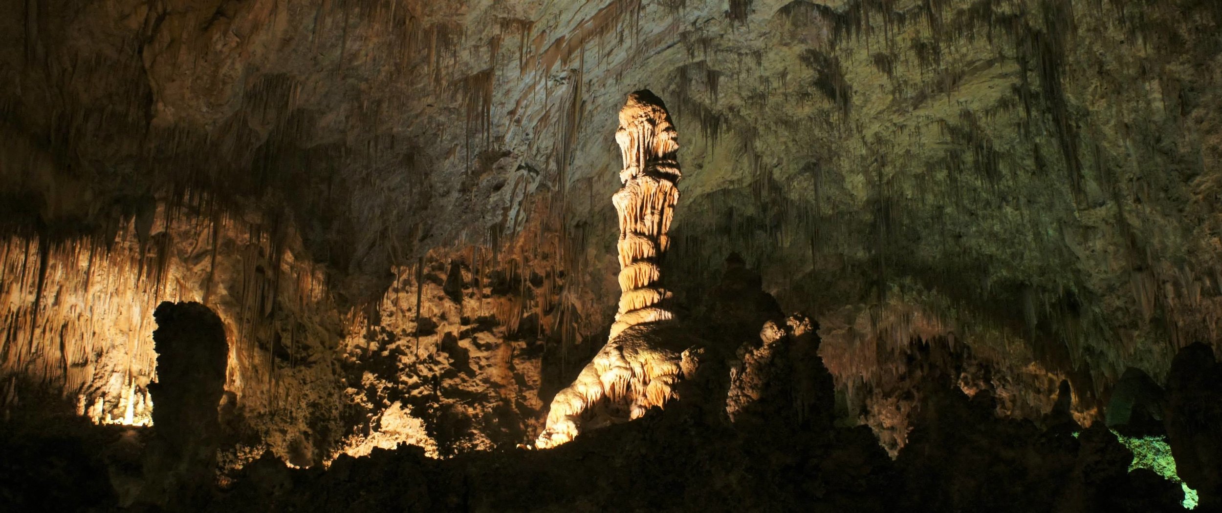
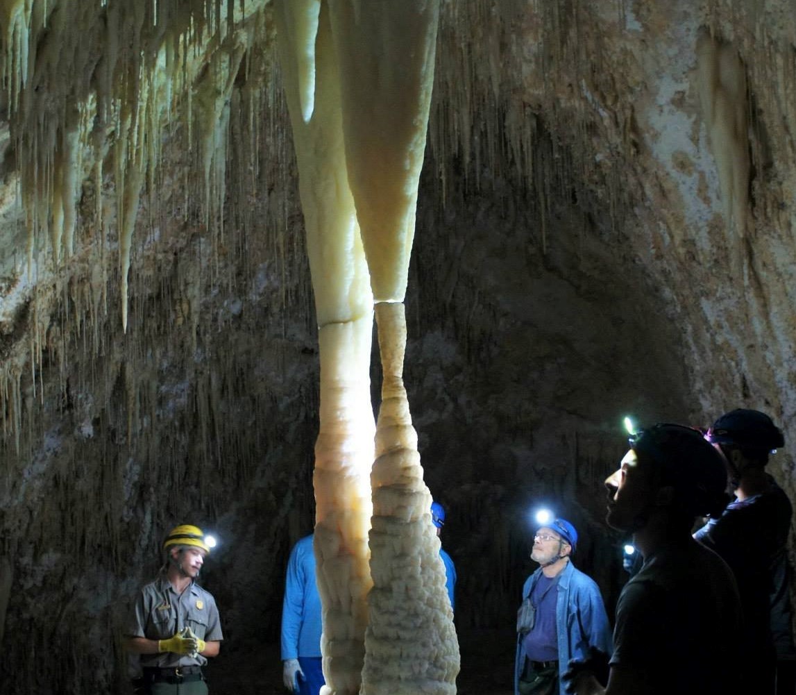
At this point on the trip, we had seen some incredibly beautiful parks and landscape features unfathomable back in California. But, by far, the most utterly amazing place we went was Carlsbad Caverns! I absolutely loved these caverns and was so bewildered by their inconceivable vastness and magnificently large and intricate formations (stalactites, stalagmites, columns, drapes, etc...). I was so blown away by this place, that to this day, when people ask me where they should go when doing a similar road trip, I always tell them "If nothing else, make sure you see Carlsbad Caverns." - direct quote, Nick Mattison.
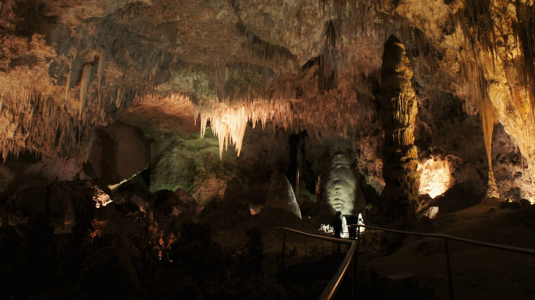
The National Parks Service does a really good job of illuminating the cavern in a tasteful way that shows off its features but doesn't ruin the natural beauty, darkness, or silence of this underworld. They also have elevators that can take you down the 750 feet to the "Big Room," making this cavern quite accessible to a variety of people.
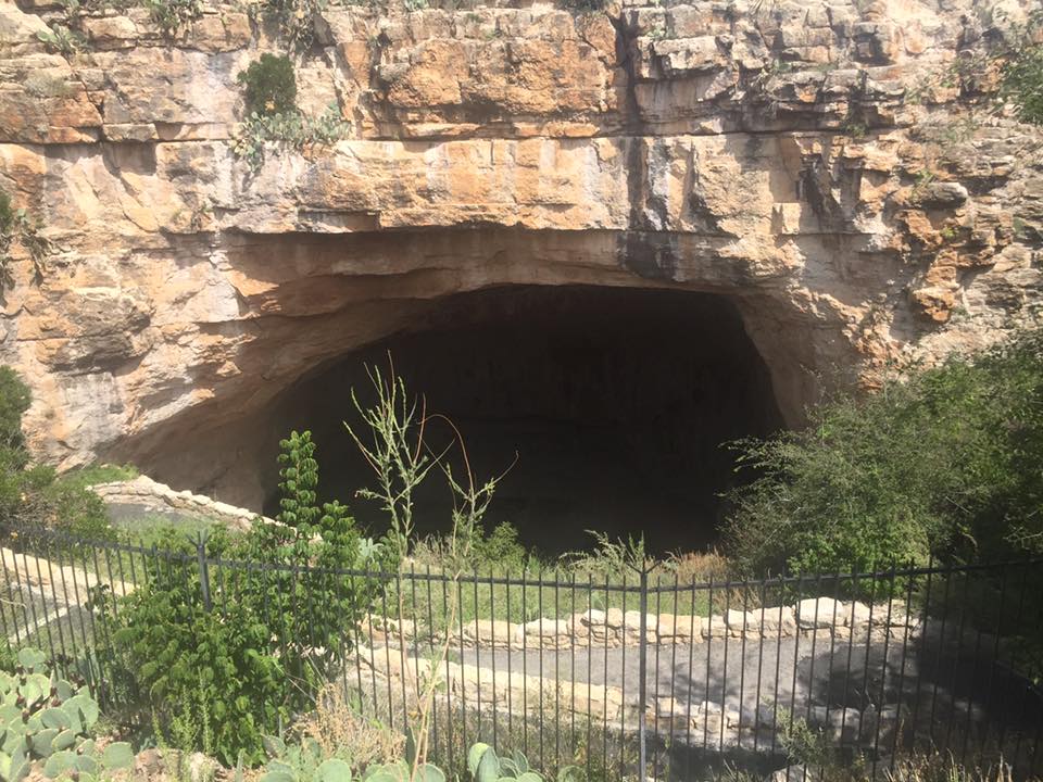
We decided to take the "Natural Entrance" path into the cavern, which included a 1.25 mile trail starting from the natural cave opening (the outside) and descending 750 feet into the abyss. Right from the start, the bat cave is overwhelmingly vast and perplexing as the ceiling seems perfectly flat other than the occasional dripping stalactite. Continuing down, it became quickly apparent that we were entering one of the most bizarre and truly spectacular places of our lives, as giant features and cave ceilings so tall you could fit skyscrapers under became our new reality.
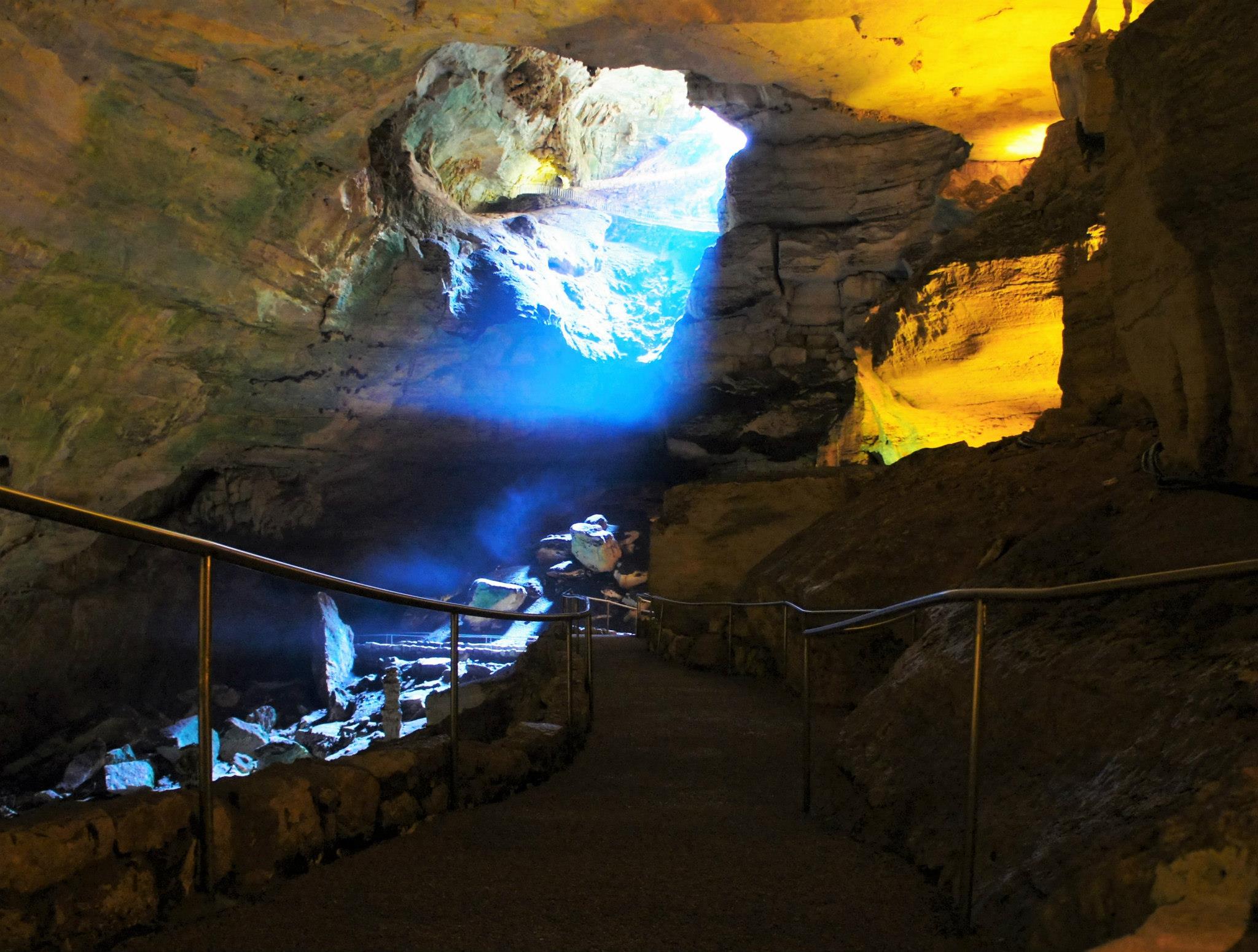
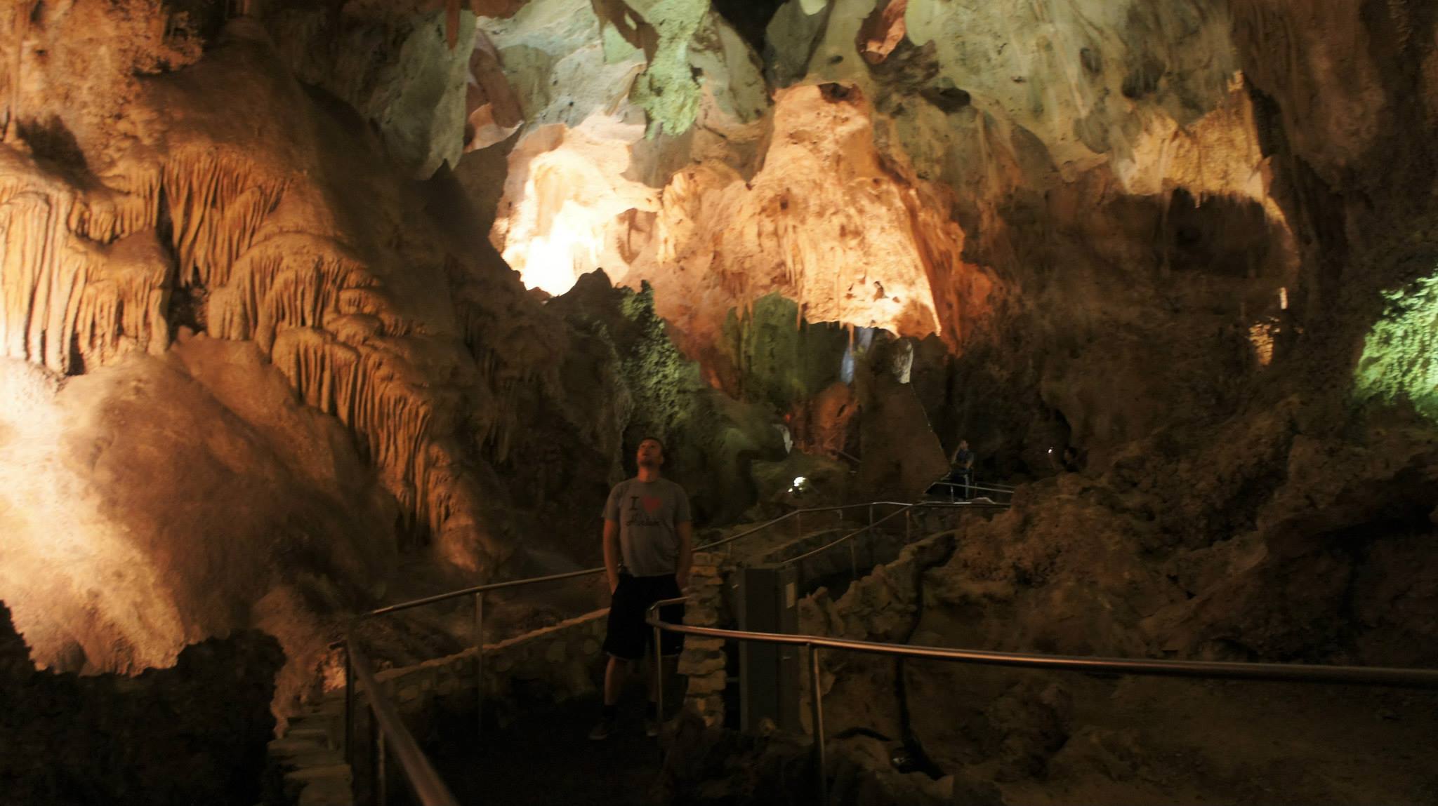
And just when we thought we'd seen it all, we stepped into the "Big Room" and... BAM... mind even more blown! This room is roughly 4000 feet long, over 600 feet wide, and the ceiling is 255 feet tall at its highest point! We followed the 1 mile loop path through this room with our jaws dropped the whole way (okay...that's an exaggeration). I'd like to tell you about all the individual features of this cavern but I think I'd need a whole article to do that (so maybe I'll write one some day). I'll say one thing though, in that room there is a lookout over a gap called "Bottomless Pit" and though I'm pretty sure it's not actually bottomless, it sure seemed like it...eerie...
Anyway, we also watched the bats leave the cave at sunset which was amazing and kind of felt like being in an episode of Planet Earth. The next morning, we did a guided tour of the "Lower Cave," which was great because it allowed us to go off the beaten path and explore parts of the cavern not accessible by the pubic and not nearly as lit/developed (headlamps, gloves, dirt, ladders, tight squeazes, WOOO!).
SAVE 25% ON AIRBOAT & SWAMP TOURS
$200 VALUE PER PERSON ACROSS 40 + TOURS & ATTRACTIONS

Austin, Tx
The road from New Mexico to Austin was long and relatively uneventful. However, we got to drive on some highways that had 90 mph speed limits, which made things a bit more interesting! Arrival in Austin was the start of a new theme on this trip. We were no longer hiking nor camping, but city exploring and nightlife focused.
We started off our time in Texas right with an enormous BBQ feast at The Salt Lick, which had an amazing indoor/outdoor BBQ atmosphere and the food was DELICIOUS.

After nearly drowning in BBQ meats, we finally made our way to the heart of Austin (The Salt Lick was a little outside the city). Though we were expecting it, Austin was still shockingly hip with everything from microbreweries to BYOB mini golf (which we totally did). On both nights, we checked out the local scene and partied at a few bars on 6th Street, or as the Austinites call it, the "Dirty Sixth."

Having been back to Austin a few times since, I can say that the one day (and two nights) we spent there wasn't enough. There are a lot of cool state/county parks nearby worth checking out too, like Pace Bend, Pedernales Falls, Reimers Ranch and others.
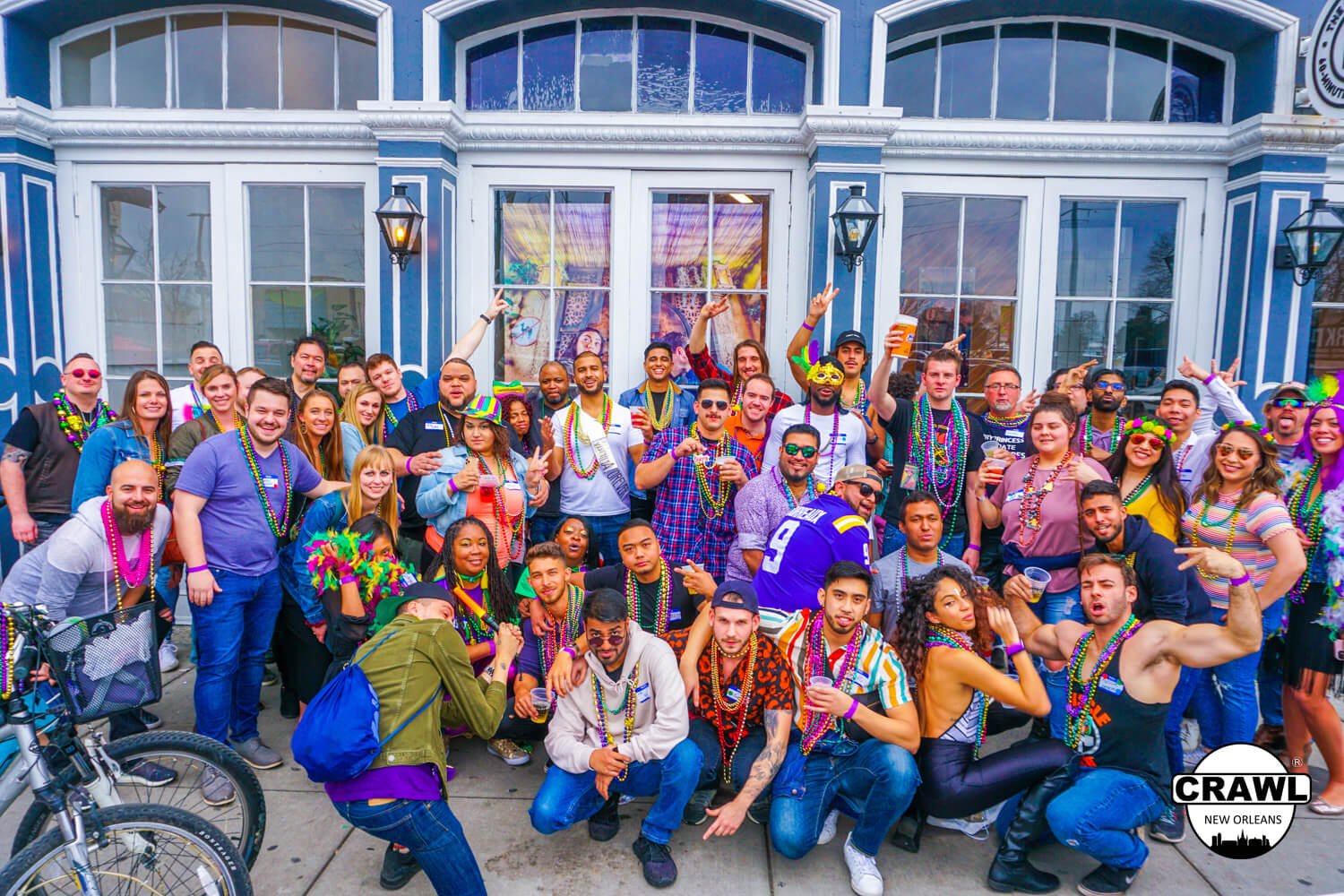
New Orleans, LA
We had come a long way; over 2800 miles in fact. But even with all that distance behind us and so many adventures completed, when we rolled up to New Orleans, the energy in the group was, for lack of a better word, STOKED! After eating a feast of fried seafood, we made no hesitation and went straight for Bourbon Street! This was the grand finale of our trip, and the vibrant atmosphere of Bourbon was perfect for the occasion.
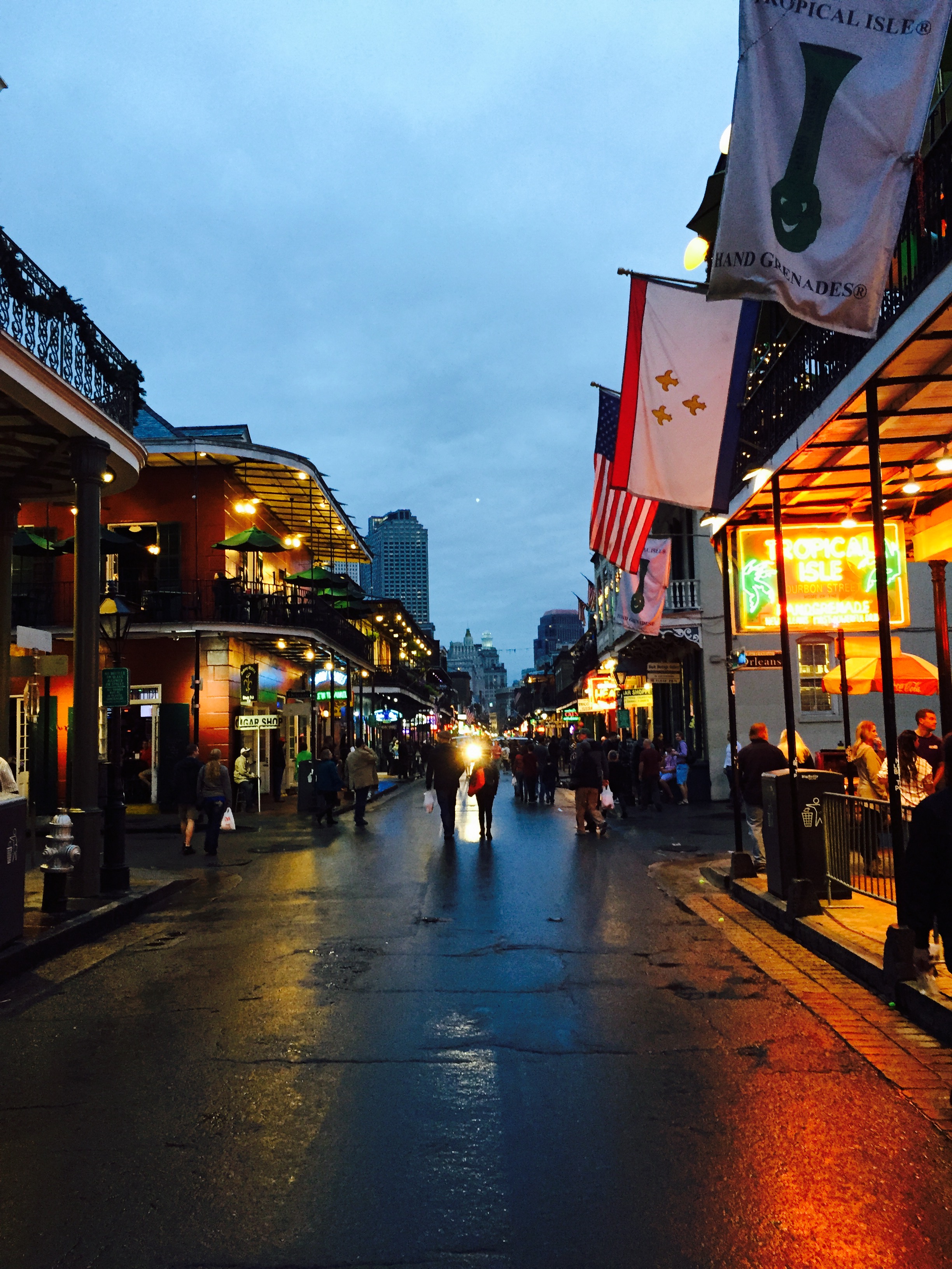
I'd go into more detail about what New Orleans is like, but there are already so many articles about NOLA on this site. Check out First Time Visiting's New Orleans Page for all the information you could possibility need to plan your trip to the Crescent City. I will say one thing, however. The drive into New Orleans on I-10 is pretty interesting because for a solid 50-70 miles, the highway goes over only swamps and bayous with no solid ground in sight.
SAVE 25% ON VIP BAR & CLUB CRAWLS
SAVE $200 ACROSS 40+ TOURS & ATTRACTIONS
Conclusion
I'll never forget this awesome excursion and the friends that made the journey with me so fun. Much love to you all.
The End...of that story.